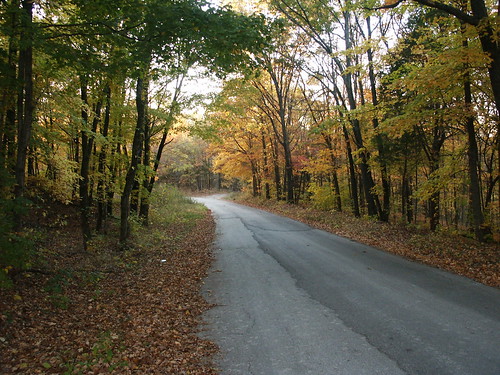
Sometimes being remote is frustrating. I can't find a name for that creek. It's not even on most of the maps, some of them just a little blue line. Sure, it barely has any water in it, but don't folks name every body of water, no matter the size?
Wednesday, December 15, 2010
Tuesday, December 7, 2010
Wednesday, December 1, 2010
Tuesday, November 30, 2010
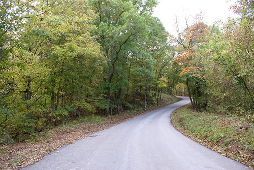
Roadtripping with streetview
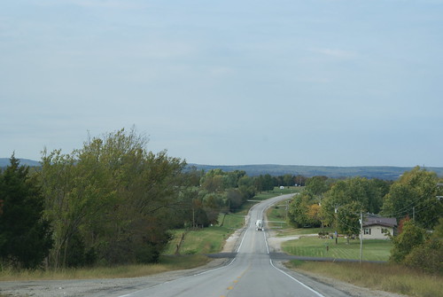
OK, so I've turned south to get back to Highway 61. The floodplain was adding a ton of miles to the journey and to be honest just wasn't very interesting. Back on 61 I'll have street view and lots of little towns to snoop around.
The jog back to 61 is an interesting one.
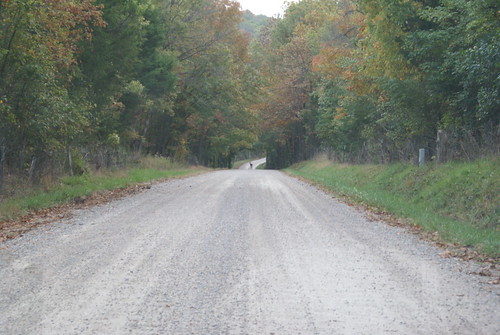
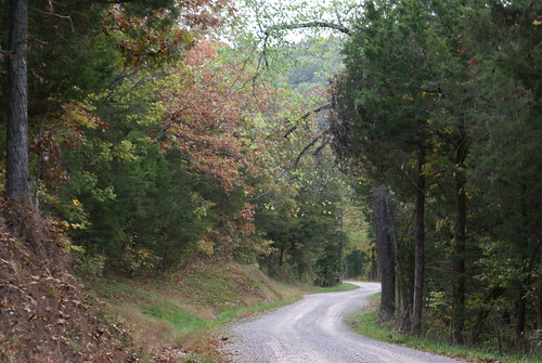
Heading up out of the river valley I got stuck behind a truck..
Saw someone who got pulled over by a local constable..
View Larger Map
Passed that truck finally..
And tomorrow I'll show you my route home - streetview slideshow style!
View Virtual "Walk Down the Mississippi" in a larger map
Monday, November 29, 2010
South of Kaskaskia Ill, in Missouri
I'm off Highway 61 for a spell, so no "streetview" but I do have a map location:
View Virtual "Walk Down the Mississippi" in a larger map
View Virtual "Walk Down the Mississippi" in a larger map
The town of Kaskaskia has an incredibly interesting story. It used to be the capitol of Illinois. Unfortunately, it's also on the flood plain, so in years like 1993, the town gets a good flooding. There's not a lot left after all these years, but they do have a Liberty Bell!
Wednesday, November 24, 2010
I've walked 800 Miles!
View Virtual "Walk Down the Mississippi" in a larger map
This days stop is just a stones's throw south of Saint Mary Missouri and also happens to land on the 800 mile marker. Since I started walking home from work two years ago I've covered 800 miles, 3.5 miles at a time.
Tuesday, November 23, 2010
Highway 61
View Virtual "Walk Down the Mississippi" in a larger map
Another bridge over another creek leading to the Mississippi.
Monday, November 22, 2010
Friday, November 19, 2010
St Genevieve

While Minneapolis freezes with 28 degrees and snow, St Genevieve has a sweltering 65 degrees and tornado watches.
One of the more picturesque towns on the river it's not actually "on" the river. It's been around since 1735, but they initially built the town on the floodplain. After the great flood of 1785 they moved the down to higher ground, albeit further from the actual river. There are a good number of old (no, really, OLD) buildings and historic sites in and around the town, and it appears to boast a good number of B&B's. Only an hour south of Saint Louis, it's a good weekend getaway, apparently. It's also the oldest European settlement in Missouri.
John James Audubon spent a part of his life in St. Genevieve, as well.
Monday, November 15, 2010
Bloomsdale, Missouri
You could check out the Dew Drop Inn ("If you have more tattoos than teeth this is the place for you, don't forget your shotgun and sister! The waitresses are grade A Angus Beef!" - online review). Seems lucky, however, with $200,000 and $1,000,000 powerball winners. You could also try the Kozy Kitchen, for more traditional fare.
While in town you could take in a show. MudBash is a big deal:
Across the Interstate is the National Tiger Sanctuary. Who knew?
Finally, if you're heading south of town, might want to see if the new bridge is in place. The old bridge from the 30's (bridgehunter link) has been demolished. Looked like a cool one, too!
They blew it up:
And yes, you have heard of Bloomsdale because it's the official north endpoint of the great "61 Yard Sale."
Thursday, November 11, 2010
Brickey's
View Virtual "Walk Down the Mississippi" in a larger map
Just another disused building along the highway, right?
This article on Brickeys has some really interesting points in it.
I can imagine some older citizen telling this story about the Fair View store:
Since business was not booming right away, the Chisms bought two little black bears from a zoo in Wisconsin to help - and it did the trick. (Later however, after one of the bears died, they tried to give away the other bear to zoos, but none would have it. Their daughter Wilma, age 16, shot the bear with 50 spectators watching and it was butchered, and a shooting match held to sell the meat, 120 choices.)
That event must have been quite the spectacle, and I just have the feeling more than one person took the public execution of the bear pretty hard.
Tuesday, November 9, 2010
Crossing the Mississippi
View Virtual "Walk Down the Mississippi" in a larger map
I'm not sure how it qualifies to be the Mississippi, but that's what all the maps say. I think it's actually Isle Du Bois Creek.
I found the following text at http://whmc.umsystem.edu/exhibits/ramsay/ramsay_sainte_genevieve.html
- Place name: Isle au Bois Creek
- Description: A small stream that forms the southeastern boundary between Ste. Genevieve and Jefferson counties and flows east into the Mississippi River. The name is French meaning "Isle of the Woods" (incorrectly spelled for "Ile au Bois"), derived from a wooded island or islands in the Mississippi River, which Marquette probably named in 1673. It is also explained, however, by McDermott (under "ile") as a term which the Canadian "voyageurs" used for patches or clumps of trees bordering a river--a grove of trees along a river bank. Also spelled Isle au Boise, Isle du Bois, and Isleaubois. The popular pronunciation Zile au Boy points to the plural form as probably the original one, for it could have risen naturally by "liasion" from "Aux Iles au Bois;" cf. Auxvasse, Ozarks, etc. (Wetmore (1837); Goodwin (1867); Campbell's GAZETTEER (1874) 281; MHR, II, 192; McDermott; Miss Welty's thesis; Mrs. Edward Schaaf)
- Source: Zimmer, Gertrude M. "Place Names Of Five Southeast Counties Of Missouri." M.A. thesis., University of Missouri-Columbia, 1944.
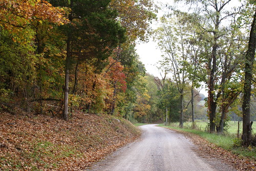
One of the things I love about the river is the fact that it goes so far back in history. Yes, the banks have all eroded this way and that and the current have changed every bit of the river every hundred years -- but the place is a constant and has been for so long. Not even considering the Native American experience with the river (will cover that at some point further downstream), the European experience goes back to 1541!
And here is a little creek, likely unnoticed by most of the people who cross it. But three hundred years ago it's possible that someone noticed it enough to name it so beautifully.
I'll bet I could fit my boat on that.
Thursday, November 4, 2010
Wednesday, October 27, 2010
Festus, for the rest 'o us!
View Virtual "Walk Down the Mississippi" in a larger map
Just past the only Catholic High School in the county, within earshot of a major highway junction. Across the way is the regional medical center. Just more highway.
Crystal City
A view of the Mississippi from Crystal City...
An interesting mini-documentary type video on the factory presence and a new prospective plant..
And a local environmental investigation piece...
An interesting mini-documentary type video on the factory presence and a new prospective plant..
And a local environmental investigation piece...
Tuesday, October 26, 2010
Just North of Crystal City, MO
 Some days there aren't any pictures, streetview, or wikipedia articles to make an interesting post. This is one of them.
View Virtual "Walk Down the Mississippi" in a larger map
Herculaneum, Missouri
View Virtual "Walk Down the Mississippi" in a larger map
It's not the prettiest area, with a large Lead Smelting plant in town (breaking news: it's being shut down). Rain. But not freezing.
66°F | °C
Current: Sunny
Wind: W at 17 mph
Humidity: 38%
Wind: W at 17 mph
Humidity: 38%
Tue

70°F | 41°F
Wednesday, September 15, 2010
What is the Walk Down the Mississippi?
I have been walking home for work for the better part of two years now. It's 3.5 miles and I do it rain or shine, warm or cold. (I actually prefer the cold Minnesota winter walks!) I took a lot of this summer off from The Walk as I was having some foot pain issues, and to be honest, got a bit lazy. Riding the motor scooter is just so much fun.
But I'm back in full swing and was looking for ways to motivate myself. One of the interesting ideas I found was the idea of a virtual walk. The idea is that you track your progress on a map using your daily walking miles. That's what this is.
I will be walking from downtown Minneapolis to my home in the Kingfield neighborhood on most weekdays. It's a 3.5 mile walk. Each day (or whenever I update it) I'll mark on the map how far that would have gotten me on my virtual walk.
Depending on my creative motivation I may even come up with a fictional travelogue to make things interesting.
Subscribe to:
Posts (Atom)